Now, for a long outdoors walk, it's not a lot different to pre-placing a key at a remote location, and going out bound to retrieve it. And that comes with the unknown of whether the "key" is going to be there when you arrive. Also, you need to go and place the key/tag/QR ahead of time.
But the whole point is that you need to "prove" you reached a point or series of waypoints ... and, well for longer distances, isn't that what geolocation can do?
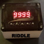
Long story short, I put together a "game" on my little lock box (I have a number if these) - the game has a list of possible waypoints in a text file, which you can select from a map (I put together a JavaScript app, calling Leaflet to do this); once you have a route selected, you hit "go" and it locks the box.
Then a second JS app, intended to run on a mobile device, monitors the geolocation. It's given the next waypoint and a radius it must be within, and shows the distance and direction to reach that waypoint from your current location. When you reach a point inside that radius, and if the accuracy of the geolocation is good enough (I used 50m as a cut-off to avoid spurious activation of a distant waypoint), it calls back to the lock box to get the next waypoint, or if it's back home, to unlock the box and finish the game. The game also has a selectable time limit after which it will automatically unlock.
I ran a few tests to be sure it all worked. I learned a bit about geolocation and about mapping apps. Google Maps is truly crap for planning walking routes (Apple Maps is better, but only a little). But OpenStreetMap has a really good database of walking tracks, showing the nasty zig-zags some of the walking paths around here take in great detail and allowing good estimates of distance and time taken. It also doesn't demand setting up API keys (with billing!) to do anything remotely interesting like Google does ... allowing things like Leaflet to just work. The downside is that OpenStreetMap is map only (no satellite/aerial view), but the map is detailed enough that I can live with that. (That said, I tend to use Google for identifying waypoint coordinates - you just centre the map on the point you want, zoomed in as far as it will go, and copy the resulting URL from the browser URL bar. My app extracts the first thing in a pasted text string that looks like a latitude/longitude pair, and uses that as the waypoint location, so you can paste pretty much any location URL from pretty much any mapping site in there and it'll just figure it out.)
Now, I haven't done a long walk for a long time, and since the app is new I did want to allow for failure. I set the box to lock until the small hours of the morning (or until the game was completed), which would be annoying, but allowed for a just-go-home-and-wait-it-out abort if something went wrong.
I chose a route that was about 5km, or about an hour's walk. I realised that while that was a good walk normally, the route did have some hill climbing, and I wasn't going to be unencumbered. Well, in for a penny...
For this first "real" run I didn't want to get too ambitious. My outfit was as follows:
- A long, stiff corset. Not too tight, but enough that deep breaths wouldn't be a thing. I put this on over a tight singlet.
- A steel wire belt with a loop securing it.
- Mid-calf, high heeled boots, with locking straps. These weren't too high but when I got them they were a bit small. I put in raised heel insoles, which added 2 cm or so to the 7-8cm height (5-6cm rise) of the existing heels. Now these boots don't have very obvious heels - they're an internal wedge, with a fairly flat looking external sole. The sole is also quite soft, as are the insoles. But still, they are high heels, with the effect of reducing stride and making downhill walking more difficult. I wore these with socks.
- A pullover hoodie. This has three slits cut in it, one on each sleeve just above the cuff, and one in the centre, inside the through front pocket.
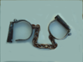
- Metal wrist cuffs padlocked to a short plastic link (made from piece of a large cable tie, with the ends folded onto themselves and riveted to form loops). I put the loop from the wire belt into the pocket through the slit, and threaded the cuffs and links through the slits in the sleeves, and through the pocket and the belt loop (locking it in place). My wrists now were trapped, but even if I pulled a hand out of the pocket to handle my phone, no-one could see the cuffs.
The outfit was pretty effective; I had corset, heels and cuffed hands, but you really couldn't tell. And I did this fairly late.
So what I found out was ...
I don't think my socks were doing me any favours. The toes of the boots caused blisters on the tops of my little toes, but I also had them on the balls of my feet by about the half way mark. That was getting a little annoying ...
The "need a good fix" requirement meant that sometimes I had to hang around a waypoint for a while while the phone figured out exactly where it was. It always sorted itself out, but I was wondering if the app needed a feature were if it had been registered in the general vicinity of a waypoint for an extended time, say 15 minutes, it would relax its requirements and call the waypoint reached. That might help if, say, a waypoint was found to be unreachable - civil works might keep one from the 20-40m kind of distance I had programmed, but relaxing that to, say, 100m after a time might allow one to just hang around for a bit to tick off an otherwise blocked-off waypoint. Need to think about that some more.
(Techy detail: phones use a bunch of technologies for geolocation, but it's mostly done by triangulating off cell towers, because that works inside buildings, even if it's not super accurate. GPS is much better, but it needs to be able to see quite a lot of sky to work - the satellites orbit at altitudes of about 20,000 km, so the signals reaching the ground are weak and don't go through obstructions like roofs or vegetation, and even if enough GPS satellites can be "seen", it takes time to get a good fix. I'd selected waypoints in fairly open areas for that reason, and made the approach radii of more sheltered locations larger. Sometimes it took a few anxious minutes hanging around a waypoint waiting for it to get a good enough fix to report it reached, especially if the route to the waypoint had a lot of trees obscuring the sky.)
With the heels and hill climbing, my calves were a bit unhappy, but not too bad. I, uh, might be a bit out of shape.
Doing this on a Monday night, I saw ... nobody. At all. No pedestrians, no cars that I recall. I'd selected a route that used primarily off-street walking/cycling paths for most of its length to avoid being seen from cars (not that it was really needed). Midnight in suburbia on a weekday is quiet.
Longer term plans: I'm thinking about doing this gagged and with knees restricted. I'd use a calf-length skirt to hide the knee bindings, a face mask to hide the gag, and a shoulder length, fairly curly wig to hide the sides of the mask, and the fact I'm not of the traditionally skirt wearing gender...
Any other suggestions for things to make the trip more ... interesting?